

Wildland fire hazard mainly high across Northwest Region
UPDATE:
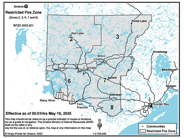
The Ministry of Natural Resources shared on May 15, "Due to the extreme forest fire hazard conditions and to reduce the number of human-caused fires, the Ministry of Natural Resources will be declaring a Restricted Fire Zone effective Friday, May 16 at 12:01 am local time for a portion of the Northwest Region (Zones 2, 3, 6, 7, 8). The area impacted will be from the Southwest corner of the USA, Manitoba and Ontario border, North along the Manitoba border to West of the midway point of Weeskayjahk Ohtahzhoganeeng Provincial Park, East to North of Wabakimi Provincial Park, South along the Western border of Wabakimi Provincial Park to the Eastern border of Quetico Provincial Park until the USA border, then back West along the USA/Canada border to the Manitoba Border
"No open air burning, including campfires, is permitted within the boundaries of a Restricted Fire Zone. Portable gas or propane stoves may be used for cooking and warmth BUT must be handled with extreme caution. All burning permits are suspended. The Restricted Fire Zone will be in place until further notice."
Tim Brody - Editor
As of the evening of May 11, there are six active fires in the Northwest Region according to the Ministry of Natural Resources’ Aviation, Forest Fire and Emergency Services (AFFES).
Two of those fires are under control, and four are not yet under control.
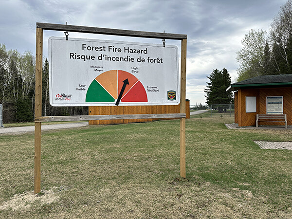
“The wildland fire hazard is mainly high across the Northwest Region. The hazard is extreme along the Minnesota border from Rainy River to Quetico Park.. Areas of Thunder Bay and Greenstone feature low to moderate hazard conditions. Members of the public are urged to be extremely cautious with any outdoor burning activity,” AFFES stated in their update.
Fires of note in the region include:
Kenora 14 (KEN 014)
• Fire behaviour conditions proved less active on Saturday, May 10 with minimal growth on the fire’s perimeter. Kenora 14 remains at 1,027 hectares in size. The fire’s status remains not under control.
• A favourable wind direction from the south resumed on Sunday, helping the fire situation by directing fire activity and smoke away from the community of Wabaseemoong. Southerly winds are expected to persist over the next few days.
• Favourable winds and lower fire behaviour afforded FireRanger crews time to begin establishing hoselines on the southern tip and western perimeters of the fire closest to structures in the fire area and the community of Wabaseemoong.
• Presently, 11 FireRanger crews are assigned to Kenora 14 with 3 additional crews to arrive on the fire line.
• Kenora 14 has a complement of 4 assigned helicopters will see an additional 3 aircraft arrive, including two heavy helicopters with increased bucketing capacity.
Dryden 5 (DRY005)
• This wildland fire is located near Peterson Cove on Sturgeon Lake, approximately 62 kilometres northeast of Ignace. The fire has been remapped at 62.9 hectares and is not under control. The fire responded well to air attack from waterbombers on Friday afternoon, which helped minimize fire behaviour.
AFFES reminds that, “Flying drones around forest fires is both dangerous and illegal. When you fly a drone near a forest fire, you can put the lives of pilots, firefighters and other emergency personnel at risk. Be safe, stay clear of forest fires.”
AFFES shared, “To report a wildland fire located north of the French and Mattawa rivers, please dial 310-FIRE. To report a wildland fire located south of the French or Mattawa Rivers, please dial 9-1-1.
“For tips on preventing wildland fires and information on the current fire situation, follow us on Facebook, Instagram and X in English and French: @ONforestfires and @ONfeudeforet. For more information about the current wildland fire situation, visit www.ontario.ca/forestfire.”
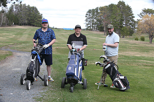
The Sioux Lookout Golf and Curling Club opened its 9-hole golf course for the season on May 9...